Kanpur, June 26, 2022: The Indian Institute of Technology (IIT), Kanpur will work to help Angul district of Odisha in developing a land and water restoration plan.
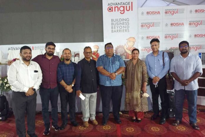
An MoU in this regard was signed recently between IIT Kanpur and the District Mineral Foundation Trust (DMFT) Angul to initiate a large project to develop land and water restoration plan for Angul, Odisha. The MOU signing was a part of a larger event on Circular Economy that was attended by a number of industry representatives and state officials.
Under the MoU, IIT Kanpur will leverage the institute’s infrastructure and technology expertise to assist the Angul district in restoring the land and water resources affected by mining.
The Angul district is enriched with several valuable minerals including coal, Kyanite, graphite, fireclay, china clay, and precious and semi-precious stones and is known as ‘Black Diamond of Odisha State’.
However, a rapid expansion of the mining operations in the region has led to loss of rich biodiversity and soil fertility, degradation of water bodies – quantity as well as quality and piling up of hazardous waste and drainage issues.
The project, led by Professor Rajiv Sinha from the Department of Earth Sciences, will use all modern technologies to develop solutions for land and water resource restoration for sustainable development of the district, primarily in the context of circular economy.
Prof. Abhay Karandikar, Director IIT Kanpur said, “The Angul District in Odisha is a very resource-rich region which needs some assistance in restoration of its land and water resources. We are delighted to be leading the efforts in developing a land and water restoration plan for the region. The team led by Prof. Rajiv Sinha will leverage our institute’s resources and expertise to achieve the stated goals of the project. This project is expected to contribute significantly towards the development of a policy document for land use, water budget and utilization plan for the Angul district based on demand and supply management, and also to contribute towards the circular economy of the region.”
The object of the project is to support the DMF for eco-restoration of the areas impacted by mining activities, particularly in terms of assessment of land and water system degradation due to human activities and their restoration.
The project will use a ‘landscape approach’ to determine the baseline conditions before the mining activities started, assess the overall degradation of the area in terms of land-use changes, impact on water bodies, and landform dynamics to map the hotspots, assessment of restoration potential of each of the hotspots, and then to develop the management plan for eco-restoration.
Major government departments supporting the implementation of the program included Water Resource Department, Pollution Control Board and Irrigation Department of Angul District.
A major highlight of this project would be the use of modern technologies such as high resolution satellite remote sensing data and drone-based investigations to determine the baseline conditions and then perform the change detection analysis to assess the degradation and to identify the hotspots.
For developing the restoration plan, the project will use the ‘landscape approach’ which seeks to provide tools and concepts for allocating and managing land to achieve social, economic, and environmental objectives in areas where agriculture, mining, and other productive land uses compete with environmental and biodiversity goals.
“Landscape approaches” have gained prominence globally in the search for solutions to reconcile conservation and development trade-offs and they focus on management of landscape resources for multi-functional uses, consider landscape diversity, and are inclusive of socio-economic perspectives.
The project will also deliver a comprehensive water governance platform which will aim to integrate near real-time observation using IoT sensors and field-based observation. The platform will be cloud-based, allowing input data from various sources, process it using a well-trained algorithm, predict possible near-future scenarios, and visualize through the analytical dashboard.
The platform would be accessible through web (WebGIS) wherein mobile devices (with desired functionalities) will be one of the sub-components to collect data from the field and visualise certain information.
The project will be hosted at the newly created Centre for Sustainable Technology, IIT Kanpur and will also have a strong training component that is aimed towards building capacities and technical knowledge of key stakeholders on landscape and water body restoration. This will also focus on building capacities on allied aspects including livelihood, natural resource management, project design and knowledge dissemination. The project will be completed in a period of about 2 years with a total cost of about 10 crores to be provided by DMFT Angul under Circular Economy initiatives of Angul District and United Nations Environment Program (UNEP).
- Under this MoU, IIT Kanpur will leverage the institute’s infrastructure and technology expertise to assist the Angul district in restoring the land and water resources affected by mining
- The project will use a ‘landscape approach’ to achieve the stated goals
- The project will also deliver a comprehensive water governance platform which will aim to integrate near real-time observation using IoT sensors and field-based observation


